
Prairie Weather This Week – August 17
This post was originally published on this site.


Prairie Weather (Rural Roots Canada) – Overall, a good week for those who’ve begun the harvest. Good…but not perfect.

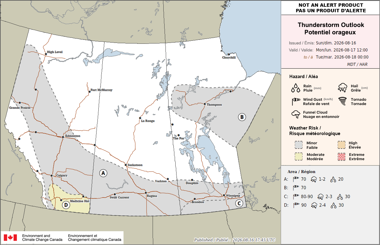
The broad pattern holds steady from recent weeks: a low lingers near Hudson Bay, sending a front sweeping across central Canada early in the week, with some thunderstorm activity over the southern Prairies to start things off.
Southern Alberta and Saskatchewan have been picking up welcome showers after a dry stretch. More rain is expected to spread through the region into the weekend, and mild temperatures should help immature crops keep progressing as the primary growing season wraps up this month.
Overall though, as the map below shows, it’s going to be a fairly dry week. Most agricultural areas will receive at least some moisture. Significant rainfall will again occur mainly in the northern forests. The map shows rainfall expected up until Sunday evening:

Nights are starting to get cooler, and frost risk is now something to think about, though there are no worries for this week. Because crops had a slower, cooler start to the maturity cycle earlier this spring, autumn frost timing will be critical to watch closer to September.
After several dry weeks, there was considerable rainfall last week over southern Alberta and southern Manitoba, while Saskatchewan was drier. The chart below shows data compiled from CoCoRaHS volunteer observers:


Wednesday
Peace Region
Some showers may develop to the south, near Alberta’s elbow early in the morning, but they won’t last long to be quickly replaced with sunshine. The Peace should see a mix of sun and cloud. Temperatures will be mild. This brings a reasonable stretch to keep chipping away at any haying or harvest backlog left over from the rain earlier in the week. Expect highs in the low to mid 20s.
Alberta
Alberta and the western Arctic continue trending warmer than normal, so expect generally settled skies with seasonal to mild temperatures in the mid to high 20s. Highs of 30 or better are possible in Lethbridge, Brooks, Milk River, Medicine Hat, and points in between. This kind of stretch, calm and dry, is exactly what southern Alberta’s crops need after a week of cooler weather with welcome rain.
Saskatchewan
A band of very light showers will cross the southern half of Saskatchewan in the early morning, arriving in south central Saskatchewan around noon. In the afternoon, the showers will simply fizzle out, and the sky clears. The showers will be spotty, and where they happen, accumulations will be under 5 mm. With the afternoon clearing, temperatures will rise to the high 20s and low 30s in southern Saskatchewan, reaching the mid 20s in central regions. This continues to favor harvest progress in the southwest and gives other regions a chance to catch up on fieldwork. Watch for any early signs of disease pressure in fields that caught the wetter stretch earlier in the month, since a run of mild, humid days can still favor fungal issues even without active rain.
Manitoba
Behind the front, conditions turn calmer, though central Canada typically runs a degree or two cooler for a day or two after a frontal passage like this before warming back up. With that, expect highs to reach only the low 20s at best across southern Manitoba and the Interlake. That brief cool-down shouldn’t slow crop development much at this stage, but it’s a reminder that the calendar is turning toward the part of the season where a cold night matters more than it did in July.
Thursday
Peace Region
Conditions should remain settled and mild under bright sunshine, continuing the calmer stretch that’s held through most of the week. A good window to keep pushing on any remaining haying acres. High temperatures will reach the mid 20s.
Alberta
It will be another quiet day across Alberta, as high pressure dominates. The province continues trending warmer than average, with highs reaching the low 30s in southern Alberta, and the mid to high 20s elsewhere. Expect generally settled, mild conditions with good working weather for both harvest prep and any remaining spray operations.
Saskatchewan
Quiet conditions should still hold today, across Saskatchewan’s agricultural regions, where it should remain mainly sunny. Rain returns to the northern forests, coming from a system in the Northwest Territories. With the sunshine, the south will reach highs in the mid to high 20s. In the north, expect highs to remain in the teens, especially in areas where it rains. From time to time, it may become quite windy in south central Saskatchewan on Thursday.
Manitoba
Settled conditions continue, with a mix of sun and cloud, and highs in the low to mid 20s. A few showers can’t be ruled out in southern Manitoba, but the rainfall will be insignificant. Overall, it’s another reasonably dry day for oat swathing and ongoing winter cereal and early pulse harvest.
Friday
Peace Region and Alberta
After some early morning showers east of Drumheller, a large surface high pressure system will keep Alberta and the Peace Region under a sunny sky Friday. It will continue warmer than average with highs in the high 20s, except in southern Alberta. South of the Trans Canada Highway, many areas will reach 30 degrees Friday afternoon. Expect another mild, mostly settled day, rounding out a good multi-day stretch for fieldwork across the western part of the region.
Saskatchewan
Showers are expected to spread through more of southern Saskatchewan today, continuing the pattern of welcome rain for a region that needed it. This should help crops still filling out ahead of harvest, and mild temperatures work in immature crops’ favor as well. Expect at least a partial pause in harvest activity in the southeast as this system moves through, though the trade-off, meaningful topsoil moisture after a dry stretch, should be a net positive heading toward September. Highs in southern Saskatchewan should reach the mid to high 20s. In central and northern regions, expect afternoon temperatures in the high teens or low 20s.
Manitoba: A Low pressure system will bring significant rain to the northern Interlake, while southern regions will see only a few passing showers. The map below shows rainfall expected in Manitoba on Friday:

Temperatures will climb only to the low 20s with the unsettled weather.
Saturday and Sunday
Peace Region and Alberta
Mild, settled conditions are expected on Saturday, but there is a chance of showers or steady rain through Sunday, coming from a developing low in north central Alberta. The greatest chances for rain will the in the Peace Region, and north central Alberta, though some showers could slip southward toward Hanna. With the dry weather Saturday, highs will range from the low 2os in the north to the low 30s in the south. With the wetter weather Sunday, highs can be expected to reach the low to mid 20s.
Saskatchewan
Just a few isolated showers can be expected into Saturday, adding to the moisture southern Saskatchewan has been picking up after a dry stretch, but only for a few will it mean another day of limited harvest progress in the southwest. Showers should intensify somewhat across Saskatchewan on Sunday, with more widespread harvest delays. Temperatures stay mild across the region, favorable for crops still working toward maturity. Highs both days will reach the mid 20s.
Manitoba
Shower chances that built in Friday continue into Saturday as the broader disturbance pattern works through the province. Keep an eye on anything recently swathed or desiccated, since repeated shower days can slow drying more than any single rain event. Conditions should start settling down by Sunday behind the weekend’s activity. Highs on Saturday will reach the low 20s. On Sunday, with the drier weather, temperatures will remain surprisingly stable, with highs again in the low 20s.
EVENT FORECASTS:
Indigenous Farm & Food Festival, Aug 18-20, One Arrow Cultural Lodge, McDowall, SK
August 18 – A mix of sun and cloud, high 22
August 19 – Mostly cloudy, chance of a morning shower, high 24
August 20 – Sunny, high 24
Didsbury Rodeo – August 21-22, Didsbury, AB
August 21 – Sunny, high 27
August 22 – Morning cloud, afternoon sun, high 30
August 23 (tractor pull) – Afternoon showers or thundershowers, high 27
Viking Chuckwagon and Chariot races, August 21-23, Viking, AB
August 21 – A few morning clouds, otherwise sunny, high 26
August 22 – A mix of sun and cloud, windy, high 28
August 23 – Increasing cloud, chance of afternoon thunderstorms, high 29
Okotoks & Foothills Pro Rodeo, August 21-23, Millarville, AB
August 21 – Sunny, high 22
August 22 – Mainly sunny with a few clouds, high 25
August 23 – Increasing clouds, periods of rain in the afternoon, high 15
Heart of the Horse, August 21-23, Medicine Hat, AB
August 21 – Sunny, high 30
August 22 – A mix of sun and cloud, chance of a midday shower, high 31
August 23 – Increasing cloud, chance of afternoon thundershowers, high 30
Manitoba Hereford Association Field Day, August 22, Oak Lake, MB
August 22 – Sunny, high 22
Ol’ Pembina Tractor Pull Society Mid-Summer Pull, August 22-23, Sangudo, AB
August 22 – Mainly sunny, high 27
August 23 – A mix of sun and cloud, high 26
Saulteaux Western Days KCRA Rodeo, August 22-23, Salteaux First Nation, SK
August 22 – Partly to mostly cloudy, high 24
August 23 – Mainly sunny, high 28
Teulon Rodeo, August 22-23, Teulon, MB
August 22 – Sunny, high 20
August 23 – Mainly sunny, high 23
READ: Wildfires in BC’s Okanagan impacting tens of thousands of farm animals
The post Prairie Weather This Week – August 17 first appeared on Rural Roots Canada.