
Prairie Weather This Week – September 28
This post was originally published on this site.


Prairie Weather (Rural Roots Canada) – Time to catch up on the harvest! We’re in for a dry week overall, with seasonable temperatures and a gusty wind at times.

With wet weather out of the forecast this week (for the most part), the harvest now becomes mainly a race against frost. Light frosts have already occurred across much of Alberta, and it won’t be long before Saskatchewan and Manitoba feel the chill.
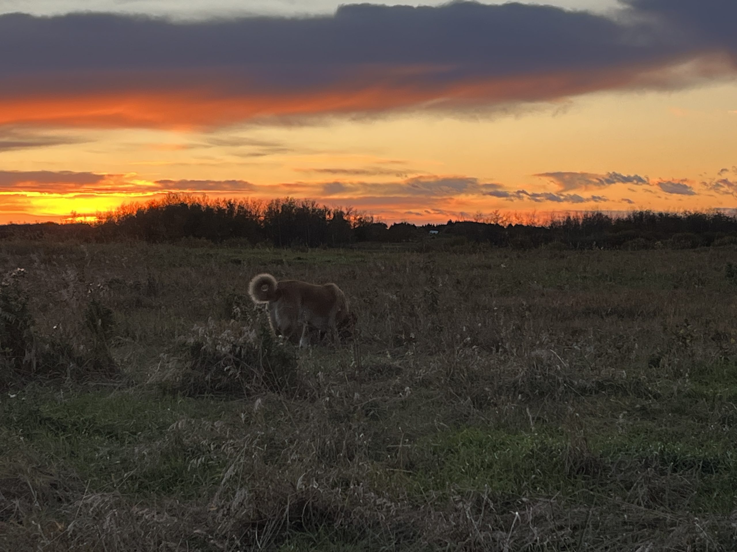
So, the combines are out 24/7… into the sunset and beyond.
Saskatchewan farmer Brad Curle caught a sunset this week from his fields east of Saskatoon, near the Manitoba boundary:

Photo: Brad Curle
Temperatures make a fairly quick rebound to slightly above normal across much of the Prairies by early next week. Hard freezes are not on the immediate horizon for the open Prairie region. Cooler mornings and the odd frost remain likely through the Rockies, foothills, and higher terrain of western Canada.
Precipitation stays generally on your side this week too. The wettest action runs along the BC coast and through the mountain interiors. It brings meaningful rain and some high-elevation snow over the mountain ranges. Precipitation is badly needed there. The Okanagan and southern BC interior remain in severe to exceptional drought. Creeks and lakes are at record lows after years of precipitation deficit. For the Prairies, less rain is exactly what’s needed right now. Harvest across all three provinces sits under 50 percent complete. It remains well behind the roughly three-quarters typically in the bin by this point in the season. A dry stretch matters more than usual.
Harvest snapshot: Alberta’s harvest rose from 22.8 percent to 42.5 percent complete as of September 22. The south is now at 64.5 percent, and central Alberta at 45 percent. Saskatchewan sits at 41 percent as of September 21. It is still behind the 82 percent five-year average but climbing. The southwest leads at 67 percent, while the northeast trails at 24 per cent. Manitoba is at 43 percent as of September 22. Spring wheat is around half done, and the southwest took another hard hit from rain this past week. Sprouting continues showing up in standing and swathed crop there. When rain backs off, harvest moves fast. This outlook gives Alberta and Saskatchewan another real shot at that.

Monday
Peace Region
High pressure builds in behind the wet weekend system, bringing a quiet, mostly dry start to the week. Temperatures trend toward a rebound across the Prairies. They run near seasonal levels, with highs in the mid-teens across the BC and Alberta Peace. However, farther north, rain is possible in the northeast corner as the departing low wrings itself out. The Peace should stay on the drier side.
Alberta
Widespread frost affects much of the province overnight into this morning. That said, this looks like a frost event rather than a hard freeze for most of the open growing area. The more significant cold stays confined to higher terrain. Regardless, anything frost-sensitive still in the field is worth getting off or protected before tonight. Expect a clear sky through the day beneath a ridge of high pressure, with highs from 15 to 17 degrees.
Saskatchewan
Dry conditions prevail as high pressure builds across the southern Prairies, aside from lingering precipitation over the far north early in the day. Afternoon temperatures will make it to the high teens across most of the province… close to 20 in the south.
Manitoba
A vigorous disturbance that blossoms into a brief but intense band of showers over North Dakota overnight pushes into southeastern Manitoba through the day. This one carries real volume, potentially delivering 15 to 25 mm of additional rainfall to areas in the southeast by Tuesday morning. Given how saturated that corner of the province already is, especially around Sprague and Vassar, watch field access closely. Regional highs will be in the mid-teens, cooler where the rain sets in.
Tuesday
Peace Region
A wind gust threat develops Tuesday morning across the Peace and into northeastern BC. Secure anything exposed, swathed canola, loose equipment, temporary storage, ahead of time. Otherwise, conditions near Grande Prairie, Fort St. John, and Dawson Creek stay near normal and mostly dry. Further north, and near the town of Peace River, expect rain. A low to the east will create some rain that will work its way west. The moisture will stretch back into the BC Peace region. Temperatures will peak in the low double digits, near 12 degrees in most parts of the Peace. The map below shows the expected area of rainfall:

Alberta
Gusty wind that develops in northwestern Alberta in the morning will shift south and east through the day. This will affect Alberta and southwestern Saskatchewan by afternoon. Outside of that, conditions in agricultural areas will stay dry with temperatures continuing their rebound toward slightly above normal. Highs of 18 to 20 can be expected south of the Trans Canada Highway. Further north, afternoon temperatures will climb to the low double digits. In northern Alberta, it’s a bit of a different story. Rain will fall throughout the day in the boreal forest, coming from a low that develops in Wood Buffalo. That low will set up some rain from Fort McMurray west to Peace River.
Saskatchewan
Dry through the morning, with gusty winds arriving over the southwest by afternoon. Regional highs trend toward seasonal to slightly above, with temperatures across the southern half of the province climbing to the 18 to 20-degree range.
Manitoba
The band of showers that moved into the southeast Monday continues sliding east through the day, tapering off as it exits into northwestern Ontario and Minnesota. Rain should wrap up in southeastern Manitoba by Tuesday morning, with drier conditions and a slight warming trend returning behind it. Expect seasonal high temperatures between 15 and 17 degrees.
Wednesday
Peace Region
Expect a mix of sun and cloud, but dry weather Wednesday. Temperatures will peak near 11 or 12 degrees. This is not warm enough for quick drying, but field conditions should improve. The wind threat will have moved on from the region.
Alberta
The wind threat returns to Alberta by morning, joined by southwestern and northern Saskatchewan, before shifting into Saskatchewan and Manitoba by afternoon. South of the Trans Canada Highway, early morning rain will taper off by afternoon. Rainfall accumulations are uncertain. The wind will come from the west, which often produces a drying effect. I’m not a fan of quoting weather models, but some are suggesting amounts up to 15 mm, which may be a bit too high. AI models are forecasting less than half that amount. So there is a lot of uncertainty, but the potential is there for enough rain to park the combines for the day. To add to the issues, as the sky clears overnight, it will get cold, and the map below shows freezing temperatures expected in many parts of Alberta early Thursday morning:

Saskatchewan
In contrast to Alberta, there is no serious frost threat for Saskatchewan, except perhaps for areas near the Cypress Hills overnight and early Thursday morning, where temperatures in the early morning are likely to be near -2. Wind picks up across the southwest and north through the morning, then spreads province-wide by afternoon as it hands off toward Manitoba. Additionally, dry conditions continue with highs across Saskatchewan ranging from 12 to 14 degrees.
Manitoba
Frost is not expected in Manitoba. Yet. A wind threat arrives by afternoon and continues into Thursday. Southern Manitoba also sits on the edge of an active track linking systems over the U.S. Midwest to northern Ontario and Quebec, which keeps a slight chance of morning showers alive there. That rain will likely be over by midday at the latest. Afternoon temperatures will run a touch above normal, with highs in the mid teens. The rest of the province stays quieter.
Thursday
Peace Region
Generally dry, though some late afternoon and evening rain may develop on the BC side. Snow can’t be ruled out at higher elevations as temperatures drop to near freezing overnight and into Friday morning. In the afternoon, temperatures will climb well into the double digits, near or slightly above seasonal.
Alberta:
Thursday is dry across Alberta. Sunshine will dominate the province, and temperatures will climb to the low to mid-double digits in the afternoon. With clear skies and higher elevation than the rest of the prairies, frost remains a possibility at this time of year. A light frost is likely south of the Trans Canada Highway Thursday night. Temperatures will drop to between 0 and -2.
Saskatchewan
The wind threat that arrived Wednesday afternoon continues through the day, with strong, gusty winds from the west. The bigger threat for the Kindersley-Rosetown area will be frost, as temperatures have the potential to drop to -3. Elsewhere, frost is less of a concern. During the afternoon, temperatures will rise to the low double digits.
Manitoba
Breezy conditions continue province-wide through the day. This should be an excellent day to return to the fields, as the day will be sunny, rain-free, and afternoon temperatures reaching the mid-teens.
Friday
Peace Region
A system moving through Friday and Saturday looks to bring meaningful precipitation mainly to Alberta, starting Friday afternoon and evening. Keep an eye on this one if you’re in the Peace. Conditions make for a dry start to the day, but bear watching as the system approaches. We’ll have a better idea of how this will play out in our midweek update here at Rural Roots Canada on Thursday. As of now, with the rain expected to hold off until late in the day, temperatures could reach the 12 to 14 degree range in the afternoon.
Alberta
There are indications that meaningful precipitation will develop late Friday and continue into Saturday. However, it’s far from certain at this point in time. We will have a better idea in our midweek update on Thursday. There are two possibilities: one involves late-day rain, or two, dry weather continues. If the wet weather develops, it won’t be until evening. Before that, we can expect afternoon temperatures ranging from 15 to 20 degrees.
Saskatchewan
The same system passing through Alberta is not expected to bring much besides wind, which lingers into Manitoba today. It will be dry and sunny in Saskatchewan, and conditions remain favourable for continued harvest. It will be seasonably warm, with temperatures rising to the mid teens in central Saskatchewan, and the high teens in the southern part of the province.
Manitoba
Wind continues as the main factor today, with drier conditions otherwise expected to hold favourable for harvest. Afternoon highs will climb to the mid teens, and skies will remain sunny.
Saturday and Sunday
Peace Region
A very quiet weekend is expected for the Peace Region…exactly what’s needed. Expect sunshine Saturday with temperatures in the mid teens. It will be even warmer on Sunday, with sunshine and highs in the high teens.
Alberta
Early morning precipitation in west central and southwestern Alberta will taper off, and the rest of the weekend will be clear and dry. A wind gust threat then affects the entire province Sunday. Much uncertainty remains, so treat this as a system to plan around rather than a locked forecast, but expect a return to drier, more settled conditions. In southern Alberta, Saturday’s highs will reach the mid-teens. Sunday will be unusually warm, with highs in the low 20s.
Saskatchewan
Drier conditions remain favourable both days. The Alberta system is not expected to bring meaningful precipitation this far east, and confidence in fine details stays low at this range. Rainfall is not expected – it should be a good weekend to catch up on the harvest. Saturday’s highs will reach the mid teens. Sunday will be warmer, with highs in the high teens, rising to the low 20s in southwestern Saskatchewan.
Manitoba
Conditions trend drier and favourable for harvest Saturday, following the wind-driven stretch earlier in the week. Southern Manitoba likely stays linked to the active corridor running toward northern Ontario and Quebec into Sunday, keeping slightly elevated precipitation chances alive in and northeast of Winnipeg. The rest of the province trends toward a quieter, more seasonal weekend. Highs will reach the mid teens Saturday, cooling to the lower double digits on Sunday, especially if the expected precipitation develops.
LISTEN:
The post Prairie Weather This Week – September 28 first appeared on Rural Roots Canada.